|
Page 2
With sunset at about 7PM we find we have there is a good bit of time to waste away before climbing into the berth. There is a restaurant about 300 yards away so we stroll over and enjoy a pleasant evening meal. On the way back we stop by the marina office to use the facilities and when I come back outside I recognize a voice. Talking with my friend is a woman I had met earlier this year on the Tennesse River near Knoxville at Fort Loudon Marina. She and her husband are traveling in a houseboat exploring the river system. They had been waiting at Midway for a couple weeks for friends from Destin to join then with their houseboat and they then planned to head back towards the Chattanooga area. As we wander back to Therapy I note a 36' Monk Trawler I had seen a couple weeks ago southbound just downstream of St. Louis, MO on the Mississippi. While we are checking Therapy's mooring lines another woman and her daughter walk up and we talk with them awhile. We find out that they are from Missouri and had been coming down the Missouri River several weeks ago about the same time I had made a trip to Leavenworth, KS. It is amazing how often the community of river voyagers cross wakes.
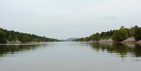
Unfortunately, our progress was short as the locks are still short spaced. Just three miles from the marina we are looking at the gates of Fulton Lock & Dam (they are ones on channel 74). We have to wait while they raise the chamber and then lock through with approximately another 25 feet drop. Once clear of Fulton we have a long run of 15 miles (!) before we radio Wilkins Lock & Dam. The wait is again short. I should mention that when passing through these closely spaced locks be sure to inform the lockmaster of your final destination. This way they know you are not just local traffic and will actually alert the next lock of you pending arrival. Not always but often they will have the chamber ready and be waiting for you which can speed the process. Still to get through 40 to 45 minutes is about the best you can expect and an hour is not unusual. And this is if there is no other traffic. The next lock is Amory and it is only five miles straight up the canal from Fulton. In fact, if it is a clear day and you are sitting in Fulton’s chamber you can see Amory when the miter gates open. Once through Amory there are a few more miles of canal but then things start to open up into more river like surroundings. Old oxbows enter from sides as well as streams and creeks. There are islands here and there as the body of water widens. This is much more pleasant to the eyes but also has a downside. The farther we go the more floating debris we are encountering. At this point is not a huge job to avoid it but forces the helmsman to keep a sharp eye on the water ahead. This can be tough hour after hour so we switch off at the wheel ever so often so we both have a chance to relax and enjoy the scenery. Fourteen miles from Amory Lock is Aberdeen Lock and twenty-three miles from there is Stennis Lock. As we approach Stennis the lockmaster has the gates open waiting. But we decide that we really need to take on fuel. The next gasoline is available at Demopolis and that is 121 miles down river. We don't have enough to make it so we call the lockmaster and inform him we need to make a fuel stop first. Columbus Marina is located just a quarter mile from the lock and we stop in and top off the tanks.
Finally the distance between locks were starting to stretch out. From Stennis to Bevill was 28 miles and then an unrestrained 40 mile run to Heflin Lock & Dam. Fifty more miles after Heflin had us approaching our destination for the night - Demopolis Marina. Entering the marina we had several things on our mind. The first was to refuel but unfortunately we found they had closed at 6 PM. It was 6:15. ?&$#^*! The next available gasoline was 98 miles downstream and right at the edge of my calculated range. I knew traveling downstream would give us some leeway but I really hesitated to push our luck. Dead in the water and floating down stream is not my idea of fun. (In fact, there was a recent fatality nearby home on the Alton Pool of the Mississippi when a barge struck a decent size cruiser with an engine out situation.) To make matters worse they didn't open until 8 AM so we would lose and hour and a half of daylight the next morning. Another item we were thinking about was grabbing a room for the night. There is a motel right at the marina and we decided that a comfortable bed and bathroom might be a bad idea. Once we checked in the next thing to address was FOOD! There was a restaurant at the marina but it was closed. The marina also had a courtesy car but it was in use by another boater. We decided to call and have a pizza delivered to the room. Not exactly a sit down dinner but lots better than lunchmeat out of the cooler.
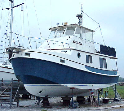
I strolled up into their lighted dry storage area an admired the trawlers and cruisers sitting on blocks. It was interesting to walk around them and look at the normally submerged hulls and drive systems. As it started getting light I walked back down to get the camera and came back for a few photos. Around home I never get to see this type of craft sitting on the dry. It was about 8:15 before the marina office opened and we were able to fuel but then we were again on our way. Well, for about three miles anyway, as that is when we came to Demopolis Lock & Dam. I had read somewhere that during the flood on 1979 the water level was 59 feet above normal pool. As we sat there waiting I tried to image how this must of looked.
Just past Bobby's at the 116 mile marker was
the last lock.
At Coffeeville Lock we had to wait about 45 minutes for a tow to exit
before
we could drop the final six feet to place us at near sea level . From
here
the run to Mobile Bay would be unimpeded. We did come upon
one very
low swing bridge but Therapy had about a foot of clearance so we did
nothing
but slow down a little. We also saw a few small craft with
fishermen
working the water. These had been surprising rare along the
entire
route.
|
 Rankin
was our last lock of the day and we were running out of sunlight when
we
ease into Midway Marina (
Rankin
was our last lock of the day and we were running out of sunlight when
we
ease into Midway Marina (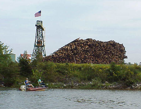 They
also told us that there were quite a few southbound watercraft holed up
there waiting to see what happens with the approaching storm.
Although
this was a concern for us too I new that we had a two to three times
faster
cruise speed and could use that to take advantage of the window between
the blows. That morning a little before sunrise we shoved
away from
the dock and pointed the bow south.
They
also told us that there were quite a few southbound watercraft holed up
there waiting to see what happens with the approaching storm.
Although
this was a concern for us too I new that we had a two to three times
faster
cruise speed and could use that to take advantage of the window between
the blows. That morning a little before sunrise we shoved
away from
the dock and pointed the bow south.
 In
less than 20 minutes we are back but now the lockmaster informs us
there
is a barge approaching and that it is a "red flag" tow. I
wasn't
familiar with the term but obviously it gave them priority. As the tow
eased into the lock its cargo was identified as benzene so I assume the
hazardous load provides them the right of way. In all
fairness to
this point there had been little barge traffic on the river and we had
done very well with little or no delays. That thought made
the two-hour
wait a little easier to endure - I guess.
In
less than 20 minutes we are back but now the lockmaster informs us
there
is a barge approaching and that it is a "red flag" tow. I
wasn't
familiar with the term but obviously it gave them priority. As the tow
eased into the lock its cargo was identified as benzene so I assume the
hazardous load provides them the right of way. In all
fairness to
this point there had been little barge traffic on the river and we had
done very well with little or no delays. That thought made
the two-hour
wait a little easier to endure - I guess.
 The
next morning I awoke very early. There was two hours or so
before
sunrise so I decided to better explore the marina area. I
snuck out
of the room and let my friend rest some more and wandered down to the
dock
to check on Therapy. There I ran into a young guy that worked
on
a river tow. He told me they had pulled in about midnight to
refuel.
"Refuel," I asked? He told me that they had a number to call
and
the marina had someone on call 24/7 to fill tows. He said
they were
there a couple of hours pumping diesel and if I had been there they
would
have fueled me too. Another missed opportunity!!
The
next morning I awoke very early. There was two hours or so
before
sunrise so I decided to better explore the marina area. I
snuck out
of the room and let my friend rest some more and wandered down to the
dock
to check on Therapy. There I ran into a young guy that worked
on
a river tow. He told me they had pulled in about midnight to
refuel.
"Refuel," I asked? He told me that they had a number to call
and
the marina had someone on call 24/7 to fill tows. He said
they were
there a couple of hours pumping diesel and if I had been there they
would
have fueled me too. Another missed opportunity!!
 Our
next stop was 95 miles downstream at Bobby's Fish Camp at mile marker
119.
Here there on the river channel there is a small floating dock with a
gas
pump on it - at least that's what it looks like. When I went
to the
"pump" I noticed there was nothing inside, just the hoses hanging
there.
Walking about 150 yards up to the office I found the actual pump with
gallons
meter. From there the gas and diesel lines run underground to
the
dummy pump on the dock. An unusual arrangement but
workable.
You just couldn't add a specific amount to the tank because you
couldn't
see the flow meters. We topped off the tank and continued
south.
Our
next stop was 95 miles downstream at Bobby's Fish Camp at mile marker
119.
Here there on the river channel there is a small floating dock with a
gas
pump on it - at least that's what it looks like. When I went
to the
"pump" I noticed there was nothing inside, just the hoses hanging
there.
Walking about 150 yards up to the office I found the actual pump with
gallons
meter. From there the gas and diesel lines run underground to
the
dummy pump on the dock. An unusual arrangement but
workable.
You just couldn't add a specific amount to the tank because you
couldn't
see the flow meters. We topped off the tank and continued
south.