|
I
wonder around the downtown area and finally decide on a restaurant.
Even though is the busiest in the area it proves to be a poor
choice. This adds to the conclusion that this will be the
worst trip for finding what I feel is decent food.
But then again, maybe I just hit the wrong
places. Going ashore wasn’t all bad as I did find a drug
store and bought a “fresh” bottle of antiseptic for my cut foot.
It was
on the return trip that I mentioned in the opening of this story that I
found myself too close to the shore and discovered an almost
submerged island. Again,
sitting and scanning the water I located another line of buoys that
were not on my chart. Once home I checked the new chart (it is on the
web) and as I suspected the channel markers are illustrated on it. Had I been using the
current chart I would have been looking for the markers and most likely
never gotten too far off course. Yea, I know – plan ahead and spend the
$$ for current charts.
Although
probably most famous for it’s shoes, Red
Wing is definitely a boating
town. Its population is 16000 and it sports six marinas along the two
miles of riverfront. It
again offers a courtesy dock although I must say it is designed for
much larger boats than Therapy. On
the return trip I stopped in for something to eat and walked around the
business district. It
was late and most everything was closed but again it was a town where I
wished I had more time to explore. Lock 3 is about six miles upstream from Red Wing at the 796.9 MM. As I made the run to the lock pleasure boat traffic was heavy and calls to the lock for passage were frequent. One of the boats traveling the opposite direction caught my eye as it was unusual but I was busy watching the other traffic and didn’t take time to look closely. It wasn’t until I was in the lock that it dawned on me that it was most likely a Glen-L Gypsy (or Quest). Now I was disappointed that I wasn’t more attentive. Would have been nice to talker to another Glen-L builder and take a look that the boat.
|
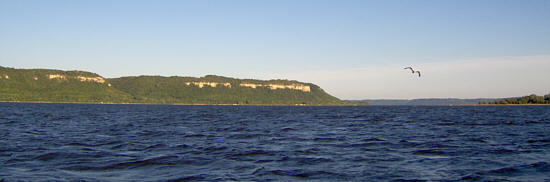 Lake Pipin is 22 miles long and about 2.5 miles
across at it’s widest point. The wind was light so the water was fairly
flat making a very pleasant ride in Therapy (Photos taken on the return
trip when a little choppy). There are several sailboats on the water
but most seem to be floundering in the light airs. Midway down the lake
is the town of Lake City and I decide to idle into the marina and see
if I can find some lunch ashore. I am informed there are NO courtesy
docks here and the rate of $5.00 per hour is charged for transients.
That figures - the only city in miles that doesn’t have a free dock and
that’s where I decide to stop.
Lake Pipin is 22 miles long and about 2.5 miles
across at it’s widest point. The wind was light so the water was fairly
flat making a very pleasant ride in Therapy (Photos taken on the return
trip when a little choppy). There are several sailboats on the water
but most seem to be floundering in the light airs. Midway down the lake
is the town of Lake City and I decide to idle into the marina and see
if I can find some lunch ashore. I am informed there are NO courtesy
docks here and the rate of $5.00 per hour is charged for transients.
That figures - the only city in miles that doesn’t have a free dock and
that’s where I decide to stop.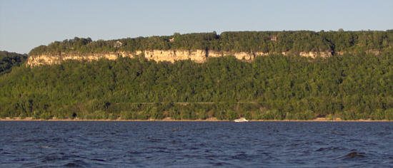 Back on the water I was
approaching the end of the lake when the 20 feet of water I was running
in suddenly went to 2 feet.
Back on the water I was
approaching the end of the lake when the 20 feet of water I was running
in suddenly went to 2 feet.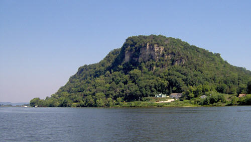 As I also had mentioned in the
opening Lake Pipin is very scenic with tall bluffs and tree lined
shores.
As I also had mentioned in the
opening Lake Pipin is very scenic with tall bluffs and tree lined
shores.