|
The Kentucky River July 2004
All right, stop laughing – I said it’s a dream! Don’t you have dreams? Sure you do. And like you have a ghost of a chance with Halle Berry!
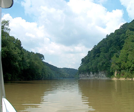
No, I have yet to find this perfect river but recently I came very close. The Kentucky River is a tributary of the Ohio River located west of the Cincinnati, OH area. It runs for approximately 250 miles through the heart of Kentucky. And although it doesn’t meet all my criteria it scores the highest of any of my river explorations to date.
One of the Kentucky River’s major assets is also its biggest dilemma. The remote access to most of its pools almost guarantees minimal use. But this was not always the case. Although most all rivers have a rich history the Kentucky seems to have more than its share. It resonates with the names of early heroes like Daniel Boone and George Rogers Clark. It was important to early commerce by functioning as a natural highway to transport fluorspar, calcite, tobacco and other agricultural products. It also played a part in the Civil War and served both sides of the conflict. It has had record-breaking structures and ingenious engineering achievements. Yet, it also was simply home to many common people whose daily life depended on its continuous flow.
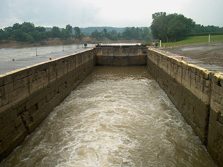
It appears since there is no longer any commercial traffic on the Kentucky River the Corps of Engineers lost interest in the system. But the State of Kentucky saw the significance and the Kentucky River Authority of the Commonwealth of Kentucky now holds jurisdiction and manages the waterway. All fourteen original locks still exist but unfortunately by 2004 only the first four are in operation and those only on Saturday and Sunday. (Check for schedules changed before planning a trip!)
But
they are a treat to navigate. These tiny chambers of hand-hewn stone
are some of the oldest operating in the country.
They still function by the original mechanisms used
for manual operation but have been “updated” and have power assist. The
sluice gates (valves used to allow water to enter and escape from the
chamber) that were originally opened and closed with T handles or
wheels driving screws now have hydraulic pumps and cylinders that lift
them. T
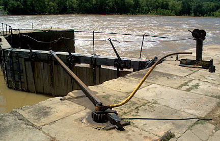
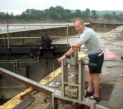
At least I thought it was a motor. I noticed the lockmasters reaching under a canvas cover and presumably pressing a switch. In fact, all the operating locks use large commercial Milwaukee drills as drive motors . At one of the locks the operator was kind enough to allow me the experience of opening a gate with this somewhat jerry rigged setup. It worked surprisingly well even though the drills seemed to be really loaded while completing the task! The lockmaster admitted they burn out a drill from time to time. (Lock pictured to the right is a lock on Muskingum River. I used the photo to show how manual operation worked. Compare to the photo below and you can see how the gear reduction and "drill" were just bolted on top tp "modernize" the set-up.)
Another item of interest to me was the pool level indicators at each end of the lock walls that were beautifully carved into the stone. One was even in Roman numerals. It just helped echo the craftsmanship that went into building these 168-year-old structures.
The operating locks allow access from the Ohio River and up the first 83 miles of the Kentucky. Because of the limited access I needed a different plan of attack to experience this river. Normally I would just dump Therapy in the water and go but this time without all the locks operating I would have to trailer from pool to pool. Some serious planning was needed to try to minimize the tow miles so more time could be spent on the water. I used a couple different computer-mapping programs to help me decide on the best routes.
I decided to start at Frankfort, KY and first travel the pools with working locks. The ramp listing showed one of the ramps in the Frankfort area to be at the Frankfort Boat Club on Wapping Street. I decided this one would work well for me but when I got there I realized it was not easy to find. It is unmarked and out of site from the road. The one-way road leading to the ramp is immediately to the west of the St Clair St Bridge. Leaving the ramp you exit into a city parking lot. There is a fee for parking during the week but weekends are free (ramp use is also free).
|
 I have
a dream.
 As the population of the area
grew the Kentucky River developed in to a vibrant working river with 14
locks and dams.
 he miter gates that were
opened by walking in a circle pushing a bar that turned the rack and
pinion gear set now have an electric motor driving them.
  To assist in this I did a web
search and found a site by the Kentucky River Authority that listed all
the existing boat ramps on the river listed under"Schedule Info" (Excel
.xls file).